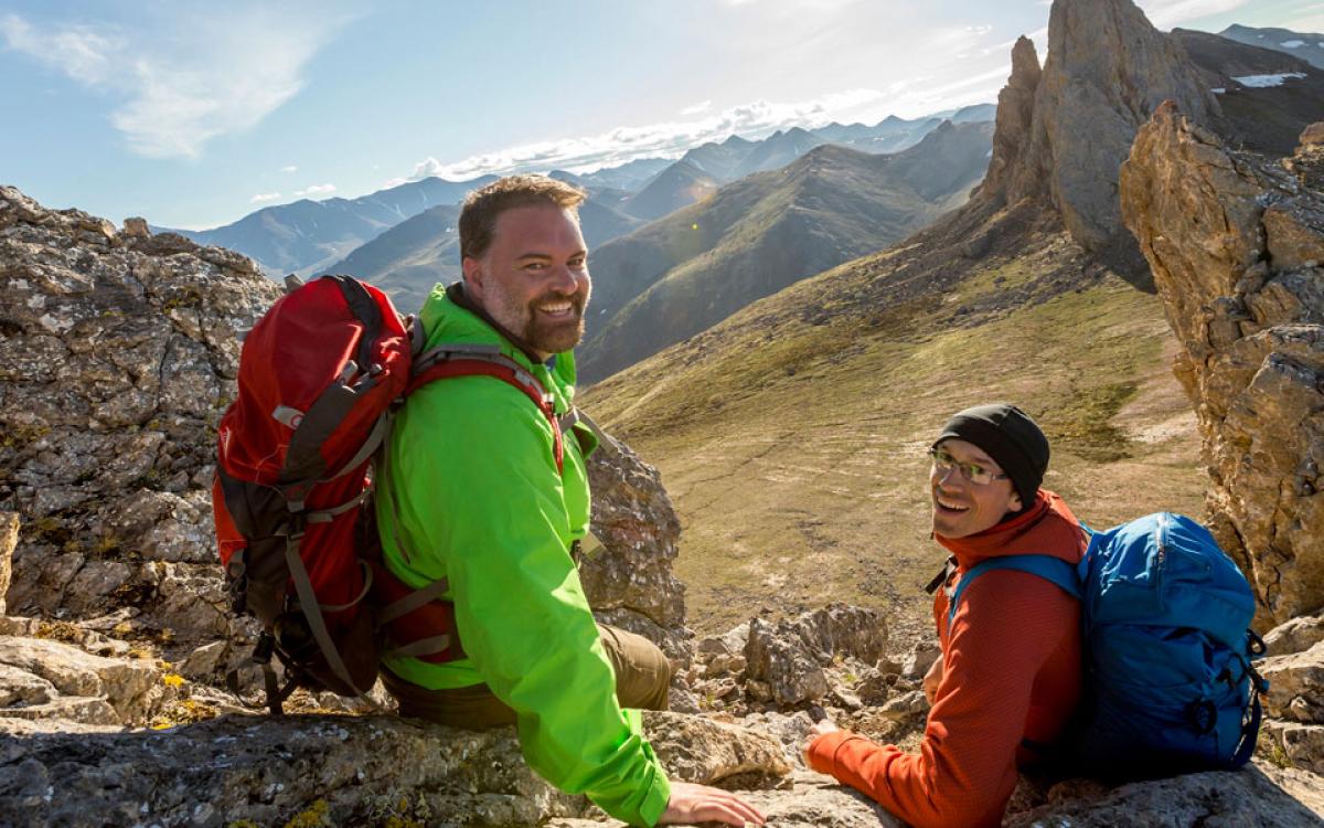
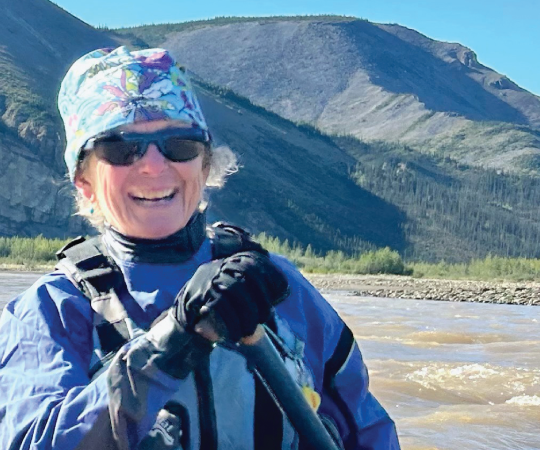
Some of our most magnificent parks are the ones even the North’s biggest fans haven’t been to. While Nahanni National Park, in the southern NWT, gets nearly 1,000 visitors per year, Quttinirpaaq National Park, way up at the top of Ellesmere Island, gets about 60, including researchers. Tuktut Nogait National Park, at the Beaufort Sea, gets less than 10. Here are some of the parks that may be a bit out of the way, but are worth the detour.
Ivvavik National Park
It all starts here
Look at a map of the Yukon, towards the top. At the farthest reaches of the territory, bordering Alaska and overlooking the Beaufort Sea, is Ivvavik National Park. It’s accessible only by air, with Twin Otters heading out from Inuvik over the Mackenzie Delta and through the mountains to touch down at Imniarvik, Ivvavik’s Arctic base camp.
Encompassing the calving grounds of the Porcupine caribou herd, the park’s name is “a place for giving birth” in Inuvialuktun. Inuvialuit cultural sites, dating back 9,000 years, dot ancient hills that were left untouched by the glaciers that moved across so much of the North as the last ice age ended.
The Firth River flows through it, host to Class IV rapids and calm pools along the way.
Whether you raft, hike or just visit this Arctic paradise, you'll never look at a map of the North the same way again.
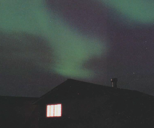
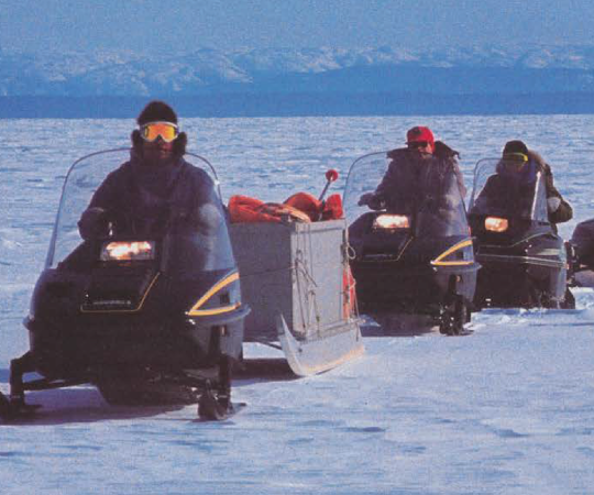
At the end of March, Rachel Hansen, an Inuvialuit interpretation officer with Parks Canada, and two other staff members jumped on snowmobiles and headed out for Sheep Creek that splits off the Firth on the park’s west side. “Each night once we arrived at our destination, the moon and stars illuminated the skies,” says Hansen. “On a couple nights, as I took a short but cold stroll around camp, I couldn’t get over how bright the Northern lights were. They were dancing from one end of the sky to the other.” On that trip, it wasn’t just the stories of the land that struck Hansen—who lives in Inuvik—it was the way they reconnected her to the past; a reminder of many nights spent at her family’s bush camp, hearing her grandmother, her nanuk, telling her own childhood stories under clear starry skies. “At that moment, I knew my nanuk was with me.” –EA
Coal River Springs
A treat for the eyes—but please, the eyes only
This isn’t the easiest place to get to. By land, you would have to somehow cross the Coal River and that’s after the two kilometres of near-impossible bushwhacking, which await you at the end of a 15-kilometre ATV trail. By water, you’re paddling and portaging up the Coal River and then dealing with a series of Class III and IV rapids afterwards. “By foot or overland or even by canoe, there aren’t great options—there aren’t even good options—for accessing the park,” says Cameron Eckert, a conservation biologist. The only other way in is via helicopter—admittedly, says Eckert, for the more “well-to-do.”
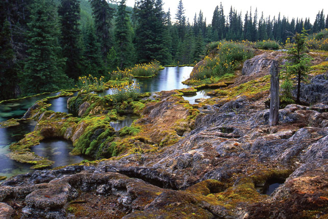
The lack of access is intentional. Coal River Springs, a 16-square-kilometre ecological reserve, is a delicate thing. As cold spring water seeps up through limestone bedrock, it dissolves the calcium and once it comes to the surface and interacts with moss and other vegetation, the minerals in the water separate and form a substance called tufa. The tufa grows at roughly two to three centimetres a year and creates new rock structures.
Kaska Dene have visited the site for centuries to take in its beauty and have taken care to preserve it. Since the tufa ponds are sensitive to alteration, visitors are asked to keep their distance so future generations can continue to marvel at them. - HM
Herschel Island–Qikiqtaruk Territorial Park
Where history may soon become history
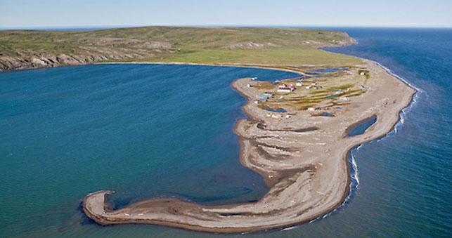
Qikiqtaruk has been many things over the years: home to Inuvialuit and their ancestors who hunted caribou, bearded seals and bowhead whales; a safe haven for European ships; the base for a short-lived whaling boom; even a ballpark for possibly the most devout baseball players to ever walk the Earth. Today, Inuvialuit continue to hunt on Herschel Island, while tourists visit the well-preserved relics at Pauline Cove.
But Qikiqtaruk—or ‘island’—hasn’t always been that. Thousands of years ago, it was actually a peninsula, connected to the Yukon’s North Slope, before water levels rose following the last ice age.
What Qikiqtaruk will be in the future is uncertain. Many of the island’s archaeological attractions—its whaling station, its driftwood and sod houses, the evidence of its storied past—are under threat by coastal erosion as sea waters rise. “Right where everything is, it was pretty much underwater this year for one or two of the storms,” says Tundra North Tours owner Kylik Kisoun Taylor.
Buildings may have to be moved. Failing that, some history could be forever lost to the sea. – HM

Tuktut Nogait National Park
Ultra-remote. World class
To even get into Tuktut Nogait National Park, you have to travel beyond where most Northern tourists view as the highest stop in the NWT. Follow the Dempster Highway up through the Yukon to Inuvik, and then—once the all-season road is finished this fall—drive to Tuktoyaktuk, on the tip of a peninsula reaching into the Arctic Ocean. Even then, you still have to fly east to Paulatuk, in Darnley Bay, before you have access to Tuktut Nogait. But rewards await you.
If you want relatively easy-on-the-joints hiking that's still rife with wilderness adventure, this is the park you want to visit. The terrain is treeless, of course, and in addition to being open, there are plenty of options for spectacular hiking on gentle landscape. There are no established trails, so a map, compass and GPS are recommended—but there's got to be some challenge somewhere, right? In late June, you'll likely see caribou and barrenlands grizzlies among the brightly coloured wildflowers and rolling hills.
If you want a paddling adventure of a lifetime, the Hornaday River awaits you. While there are no portages for much of its 160 kilometres, and plenty of space for camping, arrange your trip for before the river's massive canyon, after which the river becomes impassable. (Though it's said some expert kayakers have navigated it beyond that point.) The canyon's waterfalls, roiling rapids and steep cliffs are better viewed during a leisurely hike than from within their midst. –TE

Aulavik National Park
See and be seen in the far, far north
They had 14 days to traverse the Thomsen River in Aulavik National Park. The group of six, including Parks Canada staff and a film crew, had a few good excuses to paddle the cold waters of one of Canada’s northernmost navigable rivers; they collected water samples, surveyed lemming nests and permafrost, and hauled a 42-pound Google Trekker backpack around to document the trip.
And this 12,000-square-kilometre park on Banks Island in the Northwest Territories is quite a trip. It has river valleys and badlands and coastlines that drop down to the McClure Strait off the Arctic Ocean—the Thomsen cuts the park in half, driving straight north to these open waters.
On Day 11, the group had just pulled to shore to make dinner. Food was prepared on camp stoves, the open flame protected from the heavy wind by propped-up canoes. Before long, the group peered out from behind the makeshift shelter and noticed they had company. Six adult Arctic wolves had taken an interest in the crowd, watching them from across the river. A particularly curious juvenile even ventured across, walking up on land to within five metres of their setup, says Sarah Beattie, a resource management technician with Parks Canada. “Once at camp he took the time to walk across from all of us, and stare each of us into the eye. He held our gaze for at least 10 seconds each—which felt like a lifetime—and moved along down the line of people,” says Beattie. “For the first time, I felt a connection with a wild animal, and felt as though this creature was learning all about me just from looking into my eyes. It was a very powerful experience.”
And wolves aren’t even what the park is known for. Muskoxen can be found in the highest concentration in the world within the borders of Aulavik. The polar desert is also home to hare, fox, and along its northern coast are polar bear, seal and beluga whales. –EA

The Waterfalls Route
Roadside parks
The views along the NWT’s Highway #1 can become a tad monotonous: the never-ending line of spruce and jack pines interrupted by a few stands of white birch; the lone fuel stop at Enterprise; the odd black bear. But if you’re on the lookout, you’ll begin to notice a waterfall icon on road signs and that’s because the highway is known as the Waterfalls Route. There are many impressive waterfalls, most with campgrounds, right off the road. Here’s what to expect:
The big one: Alexandra Falls
As soon as you pull up, you’ll hear the roar of the mighty Hay River plunging 32 metres over a limestone cliff. May provides the most spectacular views—you may be lucky enough to watch the falls break up, with giant chunks of ice crashing down below.
The curtain: Lady Evelyn Falls
A six-kilometre detour south off Highway 1, on the road to the small community of Kakisa, check out the long, smooth curtain of the Kakisa River flowing over Lady Evelyn Falls. And why not try to catch lunch? Walleye, pike and Arctic grayling can be found swimming in the pools at the bottom of the 17-metre-high falls.
The canyon: Sambaa Deh Falls
The Trout River narrows and rushes through the cascading Sambaa Deh Falls directly below the highway bridge. There are plenty of spots to get an up-close look at the powerful rapids, but don’t get too close to the canyon’s edge—the sedimentary rock underfoot isn’t the most stable. (Tip: On a real scorcher, the pools just upstream are a nice place to stretch your legs and cool down.) – HM

Blackstone Territorial Park
After driving through dust clouds whipped up on the notoriously unpredictable Liard Highway, this humble campground—renown for the hospitality of its staff—might seem like an oasis. Dip your feet into the Liard River and look out to the mountains on the horizon, toward the community of Nahanni Butte. And if you stay long enough, you’re bound to meet some paddlers pulling out after a week or longer in the Nahanni. Who knows, the encounter might just inspire you to come back for more than a taste of the Deh Cho region. – HM
Kekerten Territorial Park
A monument to a monumental, bloody industry
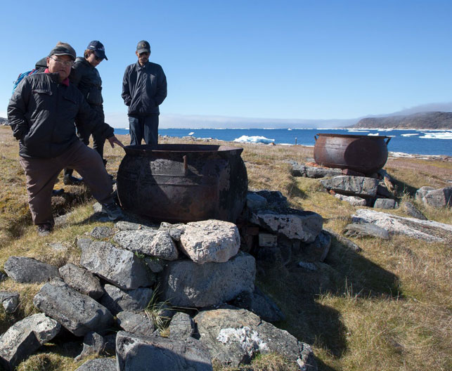
An island near Pangnirtung hosts the ghost of an industry that decimated the population of bowhead whales in the Arctic—but you have to go there to grasp the full scope. The Kekerten Island Whaling Station was one of the Arctic’s busiest when it was in operation, from 1860 to 1880. Both Inuit and European whalers used the island’s natural features to make an efficient processing operation. As the whale populations dwindled and the industry began to die, the whaling station was finally, in 1925, abandoned. Today it’s a territorial park and National Historic Site.
“You can step back in time and use your imagination to see what it would have looked like back when it was all occurring,” says Mike Jensen, who has visited the island twice with Students on Ice. “Once you know the history, the thousands of bowheads that were brought in and slaughtered, get an idea of where they were brought up onto the beach and where they were cut open and processed, you’re able to picture what sort of significance that island had.”–TE

Ukkusiksalik National Park
The mainland tundra park
"It’s absolutely beautiful country. One of my favourite places in all of Nunavut." David Pelly has lived in the North, written about the North, and paddled
its mighty rivers over the past four decades. So this praise for Ukkusiksalik National Park, in Wager Bay off Hudson Bay, shouldn't be taken lightly. "It’s not like Baffin—it’s not big glaciers and 4,000-foot cliffs dropping straight into the sea. It’s more gentle than that."
Pelly just finished a book on the area, (see p44, "The last oral history"), which is an excellent guide to the land and its history. We asked him to paint us a picture of what it looks like: "It’s got a combination of rolling hills, sort of like the area around Baker Lake, but with just a dollop of extra drama.
"You have quite substantial cliffs along the south shore of Wager Bay, the north side is a much more gradual slope, there’s a sprinkling of rocky islands, there’s several lovely rivers that come spilling out of these hills into the saltwater of inlet—so the char fishing is unbelievably good."
The first time he was there, he saw a polar bear scale a cliff like a mountain goat to get at a nest of perefrine falcon eggs. We're in. – TE

Fossil Creek Trail
Where you can really get away from it all
All it takes is a 20-minute walk from Coral Harbour’s airport to go back 450 million years in time. Back in the Upper Ordovician period, present-day Coral Harbour—and the rest of Southampton Island—were situated on the bed of a shallow, warm sea, which provided ideal conditions for coral and much of the other marine life that can now be seen petrified along the Fossil Creek Trail.
But Shunxin Zhang, a research scientist with the Canada-Nunavut Geoscience Office, says in the last decade, it’s getting harder and harder to find well-preserved fossils in the territorial park. “It’s not like when I was there in 2006,” she says. “During that time, it was pretty easy to find the fossils.” Territorial laws prohibit people from moving, altering or making off with the fossils, but this hasn’t been easy to enforce along the trail.
Not all is lost, though. Zhang says if you head west of Fossil Creek, toward Sixteen Mile Brook and Rocky Brook, you will come across fossils of ancient snails, molluscs and lilies wherever the Palaeozoic rock is exposed. “Because people don’t go that far, the fossils are better preserved than the Fossil Creek,” says Zhang. Still, that’s an impressive amount of time to traverse in a day or weekend trip.– HM

Quttinirpaaq National Park
Where you can really get away from it all
The silence in Quittinirpaaq (‘top of the world’) National Park is astounding but not constant. It is replaced, on occasion, by the sound of the wind sweeping over a glacier, off a nunatak and along the seemingly endless rocky valley in front of you; or by the ice breaking up on Lake Hazen; or by the kliu of a long-tailed jaeger, the hyip of an arctic tern. As you hike under a sun that does a 24-hour circle above you without dipping below the horizon line, you begin to wonder: Is this real? How can this be? If you’re really unlucky, you’ll hear a familiar rumble and instinctively look up—it’s a jet, six miles up—and be reminded you’re still on planet Earth.
Thankfully, says park manager Emma Hansen, she only sees about two or three jets overhead during the summer season, which lasts from late May to mid- to late-August. “It’s very rare,” she says. “Where in the world do you still get that?”
Quttinirpaaq certainly isn’t for the faint of heart—the weather can change in an instant, the stark landscape can be disorienting, the remoteness dizzying. And it can cost you a small fortune to get there. (Only 60 tourists visit each year, says Hansen.)
But it comes with great rewards. Hansen says each flower has its week of brilliance. Arctic poppies bloom and suddenly become a carpet of yellow, made all the more intense due to the contrast with its background. Likewise with the Mountain Aven’s white and the Purple Saxifrage’s violet. Wildlife is so unaccustomed to humanity that some curious caribou might approach you for closer inspection. You may see herds of muskoxen, or Arctic wolves, or bearded seals and narwhals along the coast. Even a polar bear—though we’d advise you to give them some distance. You’ll find relics left by ancient Dorset inhabitants, from historic polar expeditions, and unique geologic phenomena created by the winds and ice and cold.
If you are committed to a true trip of a lifetime, this will not disappoint. And when you return home, it may take some time to get used to the dark again. – HM

Torngat Mountains National Park
Beauty from top to bottom
Straddling the border between Nunavik and Nunatsiavut are mountainous peaks and fjords that drop to deep river valleys. Of these high peaks, 9,700-square-kilometres are encompassed by Torngat Mountains National Park.
Accessible by air or water, a basecamp set up on a grassy plateau offers visitors a launch pad to venture out among burial grounds and camps, caribou and polar bears (with proper protection, of course), and the diverse landscape of rugged mountains overlooking icebergs floating in bays off the North Atlantic Ocean.
It is co-managed by the Inuit of both northern Quebec and Labrador, as well as the federal government. – EA

