
Generations ago, Kóogháa Nélíní was a gathering place. The Tagish Kwan of what’s now the southern Yukon would travel here from up and down the river, paddling canoes or poling rafts to where the current narrowed through high basalt cliffs and turned frothy as it cascaded over the rocky floor.
Under bright summer skies, the Tagish Kwan would spear salmon close to shore in the shallow sections of the rapids and hang their catch to dry on the banks. The smell of campfire smoke hung in the air as moose and bears wandered through the forest lining the cliffs.
The water’s trajectory here inspired the name Kóogháa Nélíní, Tagish for “place where the river runs through.” (In Southern Tutchone, it’s called Kwanlin, which means “water flowing through the canyon.”) But it wasn’t only water flowing through. Other nations came to Kóogháa Nélíní to trade with the Tagish Kwan, including the Tutchone, Tlingit, Kaska, and Hän. Lined with trails and fish camps, the river —Tágà Shäw in Southern Tutchone—was a vital connector. The presence of First Nations people along the water near Kóogháa Nélíní dates back at least 2,500 years, based on tools and campfire charcoal found during archaeological digs.
These days, Kóogháa Nélíní, or Kwanlin, is better-known by a different name. In 1883, when US Army Lt. Frederick Schwatka travelled through the area, he named the site Miles Canyon after an American general. When gold was discovered 13 years later in what’s now known as the Klondike, prospectors sailed through Miles Canyon, navigating the White Horse Rapids as they followed the Yukon River to Dawson City. Today, maps and road signs bear the name Miles Canyon. It’s believed the general never set foot in the Yukon.
Names are more than just how we refer to a place. They centre a history and shape our perception of where we live—like Whitehorse, so named for the rushing water akin to a horse’s flowing mane. As recently as the 1980s, Indigenous place names were deemed unworthy by the federal government. They were considered too difficult to pronounce. This rewriting, together with the residential school system, was an attempted erasure of place names, the languages used to speak them and the stories associated with them.
Long before explorers, miners and fur traders arrived in “Canada’s North”—long before it was even Canada—it was home to Indigenous nations, languages, governance models and place names. As the territories were settled by outsiders, a literal rewriting of the land took place. English names were sprinkled onto the mountains, lakes and rivers—often, the monikers of British or American men with no real connection to the region.
Increasingly in recent years, countries, cities and communities—in the North and around the world—are facing their colonial histories. Reverting to traditional place names is one attempt to mend the harm caused by governments that tried to stamp out Indigenous cultures. Since the ’80s, when Canada gave the Yukon and Northwest Territories jurisdiction over their place names, the territorial governments have made many traditional Indigenous names official. Broughton Island is now Qikiqtarjuaq. Holman became Ulukhaktok. As this practice continues, it will encourage Northerners to look critically at the lands around us and educate ourselves about the history behind what we call these places. It may feel like a “new North” to some, but it’s a reclamation, not a reinvention. This is the original North.
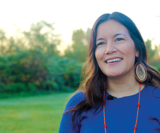
When Lianne Marie Leda Charlie moved to Hawaii in 2013 to start her PhD on modern treaty politics in the Yukon, she was impressed by the visibility of the Hawaiian language. As one of the state’s two official languages, Hawaiian names grace many buildings, streets, parks, beaches and neighbourhoods.
“People could speak Hawaiian because they were pronouncing these names for things,” she says. “You wouldn’t necessarily know what they mean if you don’t know the language, but you’re saying it.”
Charlie was born in Whitehorse, but grew up in Victoria. Four years ago, she returned home for a job at Yukon University, where she’s now a faculty member in the Indigenous governance degree program. It was then she realized the progressiveness she found in Hawaii was lacking in the Yukon.
“The settler narratives here are pretty strong and deep,” Charlie says. “To me, they have become normalized and just generally accepted.”
Every year, the Yukon Sourdough Rendezvous festival celebrates “Yukon’s tenacious, frontier spirit,” according to the government’s tourism website (though the festival recently dropped the “Sourdough”). Both Dawson City and Whitehorse’s main streets are lined with false-fronted buildings in the style of the early 1900s. The Klondike Gold Rush is heavily promoted in territorial tourism campaigns, and many Yukoners have fierce pride for this origin story. That era lives on in place names, too. Downtown Whitehorse streets are named after people like commissioner William Ogilvie and North-West Mounted Police officer Sam Steele. Outside the capital city, the community of Pelly Crossing is named after a Hudson’s Bay Company governor and Dawson City after a geologist who explored the area in the late 1880s. Marsh Lake was named after a paleontologist, Mount Lorne after a governor-general and the Robert Campbell Highway after a fur trader.
“It’s definitely perpetuating a certain narrative and a certain understanding of this place, while at the same time silencing and marginalizing other aspects of our history,” Charlie says.

Fixating on the accomplishments of these frontier figures makes it easy to ignore the gold rush’s devastating impacts on First Nations people. Those stories aren’t as well-known or well-publicized as the kooky Klondike tales of miners and dance-hall girls, but they should be. While the gold rush paved the way for the settlement of the territory—a flood of people and goods, new governance, the construction of the Alaska Highway—it forever changed the lifestyle of First Nations.
In Dawson City, where a bustling city sprang up almost overnight, the Tr’ondëk Hwëch’in were pushed out of Tr’ochëk, an ancient village at the confluence of the Klondike and Yukon rivers. The newcomers also mangled the First Nation’s name for the river they lived on: “Klondike” comes from the Hän word “Tr’ondëk”—“tr’o” being a type of rock used to hammer weir stakes into the ground for fishing, and “ndëk” meaning river. (“Hwëch’in” means people.)
The Kwanlin Dün First Nation’s history book, Dǎ kwǎndur ghày ghakwadîndur: Our Story in Our Words, outlines nine forced relocations of its people between 1897 and the 1980s. One of these moves had them living on swampy land in what is today the city’s industrial area, with raw sewage flowing into the community from another neighbourhood. In 1956, the federal government decided to lump together all the First Nations people living in the Whitehorse area to form the Whitehorse Indian Band—today, the Kwanlin Dün First Nation. (In 1987, Ta’an Kwäch’än Council established itself as a distinct First Nation; the name means “people of Lake Laberge.”)
The name of Charlie’s own First Nation also has colonial traces: Little Salmon Carmacks, named after the Little Salmon River (Tánintsḝ Chú in Northern Tutchone) and George Carmack, one of the people who discovered Klondike gold. It’s why Charlie prefers to identify by her people’s original name for themselves: Tagé Cho Hudän, meaning “big river people.” To Charlie, this name—and her Wolf clan supersede government-imposed identity markers.
“What makes me Indigenous isn’t a land-claims agreement or being a citizen of a self-governing nation,” she says. “It’s something else, it’s something bigger… I think Tagé Cho Hudän captures the longevity and the continuance of who we are as a people… It links us back to how we would understand belonging—how our ancestors would understand belonging.”

In all three territories, anyone can file an application to change a place name. Each territory has a board or program that reviews submissions and decides whether to recommend a renaming (though the territorial government has final say).
In Nunavut, Inuktut names have been formally returned to territorial communities since before its creation—Iqaluit, meaning “place of many fish,” was Frobisher Bay until 1987, for instance, and Arviat changed its name from Eskimo Point in ’89 (based on the Inuktitut word “arviq,” for bowhead whale). Today, the Inuit right to change place names is written into the Nunavut Land Claims Agreement—a process handled by the Nunavut Geographic Names Committee. When it comes to community names, like Rankin Inlet or Grise Fiord, under the Hamlet Act, a municipal council can ask the territorial government for permission to rename.
In the Northwest Territories, proposing a new name for Fort Smith, for example, or a geographical feature like Gordon Lake, requires reaching out to the Cultural Places Program, which is part of the territorial government. NWT policy allows for a place to have more than one official name; as of 2015, the Mackenzie River has six other names in six languages (Dehcho, Deho, Fleuve Mackenzie, Grande Rivière, Kuukpak, and Nagwichoonjik).
In the Yukon, the 1993 Umbrella Final Agreement mandated the creation of the Yukon Geographical Place Names Board, with three appointees chosen by the Council of Yukon First Nations and three by the territorial government. At hearings, Elders will often share oral history. The board only has jurisdiction over geographical features like rivers and mountains, so requests to change community names like Whitehorse or Carcross—have to be brought to the Yukon government by the municipality.
Indigenous governments and First Nations file the majority of submissions in both NWT and the Yukon. Recently, for instance, the White River First Nation in the Yukon sought to rename Wellesley Lake, so named in the 1890s by an explorer whose sister taught at Wellesley College in Massachusetts. “As you can imagine, Wellesley Lake is a pretty big lake and pretty important to that First Nation, so it [seems] more fitting that it should be given their name than a college in the eastern United States,” says Gord Allison, a member of the Yukon Geographical Place Names Board. The proposed name is Teku Mǟn.
Over time, renamed places do become known solely by their traditional names once more. When Allison was growing up, Kusawa Lake—now the site of a popular campground—was called Lake Arkell. “Now, I don’t even think of Arkell anymore,” he says. “It’s just Kusawa Lake”—from the Tlingit Kùsawu.â, meaning “narrow lake.”
“I think it really is about reclaiming place and space,” says Kluane Adamek, Yukon regional chief for the Assembly of First Nations. “We’ve got a long way to go—racism is still very real here. But I do feel like as a region, we’re moving forward... To have the Yukon Geographical Place Names Board in our final agreements, that’s really important.”

For almost 20 years, Randy Freeman was the NWT’s toponymist, in charge of researching place names and reviewing applications. His tenure saw several community changes to Dene names, including Łutselk’e, which means “place of the cisco fish” (formerly Snowdrift), Tulita, or “where the waters meet” (formerly Fort Norman), and Wekweètì, meaning “rock lake” (formerly Snare Lake).
“We had geologists come through here in the ’30s that plunked their names on everything—big lakes, small lakes, rivers, creeks,” says Freeman, an archaeologist and historical geographer who left government in 2001 and now works on a contract basis for the Yellowknives Dene First Nation.
Since the ’70s, the Yellowknives Dene has documented hundreds of names as part of a traditional place names project. “We are ready to put all those names onto the map,” says Elder Fred Sangris. For over 20 years, the Akaitcho Dene First Nations have been negotiating their land claim with the federal government. As part of the process, Sangris says Canada is willing to allow traditional names to return to certain places. This would mean big changes to well-known landmarks: Great Slave Lake would likely be renamed Tinde’e, “great lake” in Wiiliideh, or Tucho, “big water” in Dëne Sųłıné. The Yellowknife River—named by outsiders after the copper tools used by the Tatsaotinne (the traditional name of the Yellowknives Dene)—would become Wiiliideh, meaning “coney river.”
“Traditional place names are history,” Sangris says. He’s a keeper of many such names and stories, having grown up on the land with his nomadic parents, hunting, fishing, trapping and hearing only Dene spoken around him. He teaches workshops and talks at schools to bestow the names and stories his Elders told him onto younger generations. “It could help you relearn your language, it could help you understand your history, your identity,” he says.
Unlike the settler tendency to name places after people, many Dene names are descriptive. For instance, a spot on MacKay Lake, where Sangris’ ancestors used to canoe and spear caribou, is known as Tii Tseh’Go’o, or “spear the water.” Once, a hunter tried repeatedly to strike a caribou and was unsuccessful. “That is tied to a very important cultural event that took place there: the harvesting of the caribou, the caribou swimming, the birchbark canoes,” Sangris says.
This naming practice is common among Indigenous nations across the North. James Eetoolook is from Taloyoak, which in Inuktitut means “large caribou hunting blind.” Inuit constructed blinds—piles of stones—along caribou migration routes so they could hide behind them and hunt the animals. Until 1992, Taloyoak was named Spence Bay—according to Eetoolook, after a family member of Arctic explorers James Clark Ross and John Ross.
“It’s our land, so we want to see more Inuktitut names,” says Eetoolook, acting president of Nunavut Tunngavik. Since 2019, the organization has been encouraging communities with English names to consider changing them. Some already have: last year, Hall Beach officially became Sanirajak—“the shoreline”—and Cape Dorset became Kinngait—“where the hills are.”
Adamek sees renaming efforts as part of a broader cultural revitalization and resurgence. When she was growing up in Whitehorse, Orange Shirt Day didn’t exist. Students didn’t go on bison hunts with Elders. There wasn’t mainstream interest in beadwork like there is today. “For so long [we’ve been] pushed down, oppressed… but now we’re at a time where we’re seeing amazing steps being taken,” she says.
Adamek is Tlingit, Southern Tutchone, German and Irish. A Kluane First Nation citizen, she belongs to the Dakl’aweidi (killer whale) clan. As she’s gotten older, she’s come to fully appreciate her first name—one she shares with her First Nation, a national park and a body of water rooted in history. In Southern Tutchone, Kluane Lake is Łù’àn Mǟn, meaning “big whitefish lake,” while the Tlingit, who traded with the Southern Tutchone, called the area ùxh-àni, meaning “whitefish country.” “Kluane” is believed to be a blending of these names. “It was something that I didn’t really understand the profoundness of and now I do,” Adamek says. “I’m really proud to have that name.”

Using traditional place names is one way for Northerners to show that we acknowledge the full story of where we live and the places we love. “We don’t just live in the place where the gold rush took place,” Charlie says. “We live in a place that has a millennia of experience and story and memory, and all of this is still present.”
While the Yukon can’t deny its colonial past, it’s worth questioning whether we need to celebrate it to the extent that we do today, and examining how that celebration clashes with the territory’s self-image as a progressive partner of Yukon First Nations.
In Charlie’s view, changing place names alone isn’t enough—it should be paired with material changes as well, like the transfer of land or economic control to Indigenous people. But it’s a starting point. Our full history should be on display, instead of canonizing tales of sourdoughs and cheechakos and burying the realities of racism, disease and displacement.
For now, Miles Canyon remains Miles Canyon—evoking General Nelson Miles, who battled Indigenous tribes on the plains as part of the US army’s effort to force them onto government reservations. At Canyon City, just south of where the Yukon River flows between the high cliffs, relics of gold fever remain—rusted cans, a tramway cart. But before a small townsite sprung up here, with a saloon and North-West Mounted Police post, there was a fish camp, with a trail that connected Tàkwädàdhà Mǟn (Southern Tutchone for Marsh Lake) and Tàa’än Mǟn (Lake Laberge). It’s believed that part of that ancient route forms the modern-day Yukon River Trail—a popular place for biking, running and hiking. From Canyon City, the trail climbs a steep hill and, at the top, offers expansive views of Tágà Shäw and nearby mountains, including Sima (Golden Horn) and Thay T’äw (Haeckel Hill).
These names do more than represent a geographical place. They hold within their words an opportunity to learn new stories about the lands we love and to recognize how we remember the history we want to remember.