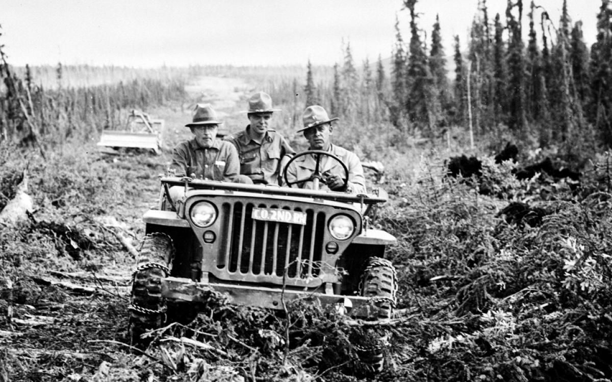
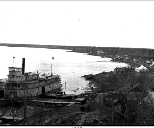
Ross River, Yukon. 1942. The Kaska Dena living here were not strangers to white people. They’d met missionaries, Northwest Mounted Police, fur traders and the like, as they travelled about the Yukon on its river systems. But they weren’t prepared for what was about to happen to them. Twenty thousand southerners with mighty machines were on their way to this territory of close to 4,000 people, from all across the continent. No one was prepared for this.
It was the greatest infrastructure project Canada’s North has ever seen, built in record time. The Alaska Highway, starting at Dawson Creek, B.C. and ending in Fairbanks, was planned and paid for by a foreign government to aid in a war that had engulfed the entire world but hadn’t touched the wilderness north of 60. Northerners today might say, “It’d take a war with Russia to get a highway up the damned Mackenzie Valley” and spit and grumble. But while the highway has put the Yukon far ahead of its neighbours in accessibility and industrial opportunity today, such towering achievements always cast shadows. The unwitting inhabitants of the land saw their world disappear without warning in moments, and the new one bore a heavy cost.
“The folks in Ross River started hearing these incredible mechanical noises,” says Ken Coates, a historian who’s written extensively about the North, and the Canada research chair for regional innovation at the University of Saskatchewan.
“They knew outboard motors, they knew other kinds of machinery; it wasn’t as though an engine was a radical thing for them. But they hear these incredible noises and see lights flashing on the other side of the Pelly River, and they look up and see these big bulldozers coming over the hill, pushing out a rough road. From nothing to that—that’s amazing.”
"If you can use the highway to go south to north, you can use the same highway from north to south.”
The world was at war, and in 1942 the Allies weren’t yet winning. Japan had expanded rapidly into the Pacific after its December 1941 attack on Pearl Harbor. It had taken the Phillipines, Burma, Singapore, and a small (diversionary) force had occupied the Aleutian islands of Attu and Kiska. Though minor, it was the first foreign invasion of American soil in 128 years. “At a time when the world was being buffeted by Nazi Germany and the Japanese, the idea that the Axis powers would collapse on North America, in retrospect, was kind of unrealistic,” says Coates. “But at the time it wasn’t unrealistic.”
Shortly after Pearl Harbor, the plan for the road was set in motion. But outside the American government, nobody really thought the highway was a good idea, says Coates. Canada believed it a waste of money and many in the army thought it might be counterintuitive for continental security—“If you can use the highway to go south to north, you can use the same highway from north to south,” says Coates. But president Franklin Delano Roosevelt went ahead and announced the road in February 1942, and troops were there the following month. Canada’s contribution was basically just to not oppose it. Already two years into the war, Canada—economically dwarfed by the U.S. to begin with—was selling war bonds to keep afloat.
There were three options for the route, according to Coates: a scenic route that branched off from Hazelton, B.C. and went through rugged mountain passes; an easier (and previously surveyed) route that would have gone through the Yukon’s mineral-rich Tintina Trench; and another route, a late-comer, being push primarily by North Dakota and prairie province politicians, who wanted post-war Alaska-bound traffic to cross through their cities. And their gambit succeeded. This third route would run near and parallel to the Northwest Staging Route, a series of airstrips built in northern Alberta, B.C. and the Yukon, again by the Americans, to ferry airplanes to Russia before the U.S. officially entered the war after Pearl Harbour.
So the army pushed a road through the wilderness “with ferocious speed,” says Coates. Though it’s commonly said that the highway was finished in eight months, that’s a bit of a fib—a road was indeed finished between February and October of 1942, but it was rough and temporary. Its bridges were quickly washed away. A federal, civilian road-building organization called the Public Roads Administration followed the soldiers’ battered path, rendering the cleared path into a highway for 2,414 kilometres.
“Many more would have died if the military hadn’t, frankly, ignored the rules and provided medical care for the aboriginal folks."
“Can you imagine getting whooping cough and then getting the mumps and then having the flu, and then the measles comes on top of that? Each one batters you into the ground, and you have them successively over the course of 12 months, you don’t recover for a very long time.” This, says Coates, was life in Teslin, Yukon, when the southern soldiers arrived, bringing diseases that the local aboriginal people hadn’t been exposed to before.
Measles, dysentery, jaundice, whooping cough, mumps, tonsillitis, meningitis or some awful combination of the lot affected nearly all of the indigenous population along the highway. Telegraph Creek lost most of its elders. Parents lost their infant children—in a paper written by Coates, published in The Alaska Highway anthology, he recounts a woman’s story detailing how construction workers would stop building the road in order to construct caskets for children. In all, 64 aboriginal people died of these diseases in 1942, and 52 died the next year, according to Canadian federal vital statistics reports.
Despite unknowingly bringing the diseases with them, many soldiers did try to help in ways that they could. “Many more would have died if the military hadn’t, frankly, ignored the rules and provided medical care for the aboriginal folks,” says Coates. But the diseases were here now. As was the road. As were the white people. Though the soldiers and construction crews would go back home, the highway opened up the Yukon such that aboriginal people were soon in the minority, and that lopsided ratio remains today—less than one quarter of the population is aboriginal.
The highway has been said, by Yukon elders, to be the primary catalyst of the decline of their traditional lifestyle. It came about as the fur industry foundered. Automobiles and the wage economy captured the attention of the young. Alcohol was suddenly more prevalent, brought up with the soldiers and the Canadian and American civilian construction crews.
Coates says the soldiers and builders hunted and fished with reckless abandon along the highway route, decimating caribou populations—there is even some evidence of dynamite fishing. “Luckily they didn’t venture too far off the [highway],” says Coates.
Of course, the road allowed more goods to be easily sent to communities, and expedited the delivery of essential services, like medical care. And it created prosperity in the camp-turned-town of Whitehorse. The army had constructed a pipeline through the Mackenzie Mountains from Norman Wells, NWT, to the Yukon, and that oil was to be refined in Whitehorse. The CANOL pipeline operated for about 14 months, the refinery for about 12—but Whitehorse continued to prosper as the transportation hub for the Yukon. In 1953, shortly after Dawson City was connected to the road system via the Klondike Highway, the history-drenched former capital was forced to send its crown south. Whitehorse, a city for just over two years, was designated the new capital.
The road opened up the territory to all sorts of industrial activity—forestry, oil and gas, telecommunications and, most importantly, mining. The Klondike Gold Rush was long dead, but copper, silver, lead and asbestos were among many lucrative minerals in abundant supply in the now-accessible northlands.
It could have had a much stronger effect, though. Coates said the route chosen proved to be much more difficult to maintain than would have the route through the Tintina Trench from B.C.—and “the economic development of northern B.C. and the central Yukon would have happened sooner probably.”
Without a grand road like the Alaska Highway, the new world has taken longer to reach the rest of Canada’s North. Twenty-one of the NWT’s 33 communities still aren’t connected to the road system. But with television, internet and high-paying diamond mine jobs, fewer young people are living traditional subsistence lifestyles. In Nunavut, there’s been less economic activity—and no road connections at all—but the culture creep has made it there too. Communities are semi-isolated—accessible just enough to lose the cultural shield that isolation can provide, but inaccessible enough to make life expensive.
Today’s North is largely dependent on the modern Western lifestyle. A few hunters and trappers eke out a living on the land, but those skills are no longer ubiquitous. People live in houses heated by oil, which costs money—as does food, airplane tickets for travel, clothing. Hunters must pay for snowmobiles, gasoline and bullets, and the caribou—a dietary staple in both the NWT and Nunavut—are in serious decline. Alcohol, though banned in most Northern communities, still makes it there. As do drugs. Homes fall into disrepair, specialty health and veterinary care sweeps through sporadically. Some communities lack adequate policing to combat high rates of violence. There is hardly any work.
Now we need roads. But since the Second World War, infrastructure projects in Canada’s North have come in slow drips. “For the demonstrable good of the people who live there” sounds like a much better reason to blaze a path through the wilderness than “so we can service airstrips and bring tourists through the prairies,” but somehow it hasn’t attracted the same ambition that carried tens of thousands North almost overnight so many years ago. Will it take another war to get a highway up the Mackenzie Valley or from Churchill to Rankin Inlet? Let’s hope not.

