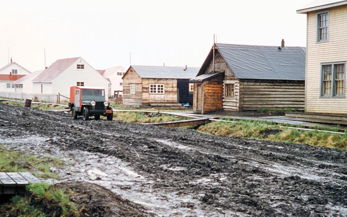
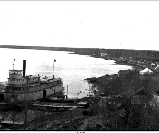
The North is scattered with abandoned trading posts, mine sites and the skeletons of past communities. In an elbow of the Peel Channel on grass-covered land that’s half soil and half ice, Aklavik, NWT almost became one of those places. With the channel cresting its banks every spring, threatening the community on shore with floods, the Government of Canada gave up on it and shuffled services to a new community it was building, 60 kilometres east, called Inuvik.
“Aklavik was expected to die a natural death,” wrote A.M. Ervin in a report to the Department of Indian Affairs and Northern Resources in 1968. “Indeed, it seemed that this was going to be the case, since at first many people left the settlement to participate in the construction of Inuvik, and very little government capital remained operative in Aklavik.”
Everything was working against it, but Aklavik wouldn’t die.
In the 1950s, Aklavik was thriving. Its population would swell past 1,500 in the spring as hunters and trappers headed into town with their families in tow, to gather and celebrate after the muskrat season ended.
“There were a lot of celebrations and other activities happening in the evenings right up until July 1 when they celebrated Canada Day. This was a lively little town, I remember,” says Aklavik mayor Charles Furlong. “People from all over used to come here just to take part in the dances and things like that.”
The mission schools were still operating at the time, in one building—Roman Catholic on one side and Anglican on the other. The denominations had their own churches, as well as hospitals. “Everything was two here, eh?” says Furlong. It was a town of plenty. As the centre of the Mackenzie Delta, the community also had government offices, an armed forces base and a local newspaper, the Aklavik Journal.
But to the Government of Canada, it was a town with little chance of expansion, a shoddy sewer system, no airstrip and a looming flood risk. So the bureaucrats began to look elsewhere.
Several sites were scouted between 1953 and 1956—six on the east side of the Mackenzie River and six on the west. “They were going to choose a site that was just west of Aklavik, under the mountains there—I believe it was even surveyed—but for some reason it didn’t meet their longterm expansion plans and all that, so they went east,” says Furlong. A site on the east channel of the Mackenzie River, about 100 kilometres from the Beaufort Sea, was eventually selected. Positioned on a large flat expanse, it wasn’t at risk of flooding and had room to grow.
“Aklavik Sinks in River Mud, Site Chosen for New Town” reads a March 28, 1955 National Press headline. The move was watched closely in the south. It wasn’t every day that the government built a new town from scratch–and not just any new town.
“The new settlement was planned to be an area which would have improved educational, health, and welfare facilities. This was to be a model Arctic town, proof that living facilities of southern Canada were viable in the Arctic,” wrote Ervin.
There was debate around what to call the new government town, including propositions that it be called New Aklavik, or just plain old Aklavik. But those weren’t going to work if the original community still existed. And according to the March 1956 issue of the Aklavik Journal, there were plenty who “ain’t gonna move.”

The decision to relocate the town was made with limited input.
“The [Aklavik] town fathers were all white people—made up of white trappers and other things like that,” says Furlong, who was about eight years old when talks of the move started up. “They’re the ones that talked to government. I never really heard of any aboriginal people pushing for it.”
An Aklavik Relocation Advisory Committee was formed in 1954, bringing a few more local opinions into the mix, but southern engineers and bureaucrats were behind the site selection and planning of the new town.
Ervin recounted years later: “There is still much indignation among the permanent residents of the Delta over the fact that they were not consulted to any great extent in the selection of the Inuvik site, nor in the actual planning of the town. I was told that the residents of Aklavik received their first news of the choice of the town’s location from an American radio station in Fairbanks, Alaska.”
In those days, Furlong says, most people were still living off the land: hunting, fishing and trapping. The fishing was good around Aklavik, it was close to the caribou and established traplines. Families had camps surrounding the town, only coming in for certain holidays or to trade. “It just wasn’t to the best advantage to move to Inuvik. They were leaving everything here,” says Furlong. “Native people really didn’t know that part of the country and they knew here what Aklavik had to offer was all the traditional food they needed and the trapping was good, so they weren’t going to move.”
But the new town wasn't exactly destined to fail. One thing it had plenty of, that Aklavik no longer did, was jobs. Southerners were brought up for various positions during the build and locals were hired for others—some already having the skills needed after working on the DEW Line, says Furlong.
As part of its employment training program, the federal Department of Indian Affairs and National Resources sent two Aklavik men to Toronto to learn diesel equipment operation for the move. Out of 40 candidates, Peter Thrasher and Elijah Kotok were chosen to work at the G.W. Crothers Plant in Toronto’s Leaside neighbourhood, under foreman William Howard. His daughter, Jeanette Rausch, remembers her dad training the two men who had never before been outside the Northwest Territories. Roche was 14 at the time—she laughs that all she recalls of her dad saying after days in the shop with the men was that they'd never eaten a banana before.

A story from the now-defunct Shell News, in April 1955, recorded their stay in the city: “The height of buildings amazed them; in Aklavik they said there wasn’t a building more than two storeys high. The heavy traffic, too, was novel—no traffic jams in the old hometown with its single car and few armed service vehicles. Niagara Falls impressed them, but not for the usual reasons. They had little to say about the waterfalls themselves but they were struck by the fact that in mid-winter the river was ice-free.”
There were jobs in the dismantling of Aklavik itself. From 1955 to 1959, goods and equipment were moved by air and water to the new site, even entire structures. The 512-square-foot military buildings—some are still around today, known plainly as 512s—were placed on barges and shipped down the channels. Furlong’s father and relatives were a part of the construction effort; he’d stay with them for a few months in the summer, seeing the progress of roads cutting through and utilidors built up across the landscape. “It was exciting times, prosperity and lots of work,” says Furlong. “When the dust settled, everybody chose where they wanted to live.” ˚

With so many people taking construction jobs, not to mention the public service positions that moved across the river, the population of Aklavik was down to around 820 people by 1955.
There were some who welcomed the opportunity to start again in a new town, just a 120-kilometre drive away on the ice road, or by boat in the summer. “The transient people were glad to move to Inuvik,” says Furlong. Population data would underline his point: between 1958 and 1961, the population of Aklavik declined from 700 to 605—not a major drop, until you look at the demographics. The number of white people declined from 350 to 138, while the Inuvialuit population increased from 150 to 222. (Gwich’in and Metis data is lacking.) Aklavik’s population overall rebounded slowly and slightly, growing to 661 by 1971, and 781 by 1976. Today, 677 people live there.
The first data Statistics Canada recorded for Inuvik was in 1961, at which point 1,248 people had settled into the new town. The population grew to nearly 2,700 in 1971 and more than 3,000 by 1976. That remains its population, with two-thirds identifying as indigenous.
With so many people headed to Inuvik, it was inevitable that many businesses would follow. Stan Peffer, whose father opened a store and the hotel in Aklavik, sold off his assets and moved over to the new town, quickly re-establishing himself. He rebuilt what’s now the Mackenzie Hotel in Inuvik, says Furlong, and then set to work on a recreation hall.
“The missions never took much out of [Aklavik]. They kind of left all of their buildings here and took what they needed,” says Furlong. “They re-established themselves in Inuvik when they started building the two hostels and missions there.”
After Aklavik’s high schools closed in 1959, students boarded in Inuvik for their secondary education. With the institutions moving, employment was scarce. “People missed the work but life went on,” says Furlong. “There was still a lot of good trapping, so people were making money that way.”

Inuvik quickly established itself as the regional centre for the Beaufort Delta. The territorial government remains a major employer in town, while the promise of oil and gas development has toyed with the population for decades.
Aklavik has also seen its ups and downs. Some people left, some people stayed, some went away and gradually returned. Those who remained would see Moose Kerr School open in 1969—named after the principal who fought to save the town. In the 1960s, he proposed a new slogan—since then, the Aklavik flag has borne the phrase "Never Say Die." In 1974, Aklavik gained hamlet status, meaning an elected mayor and council could pass bylaws. In 2006, the waters of the Peel Channel flooded the streets of Aklavik and forced the temporary evacuation of some residents. But even then, no one threw in the towel.
“It wasn’t all about economics and a better way of life but more a continuation of our culture and traditions and just being who we were,” says Furlong. “Aklavik is still booming, everything is still here—a lot of people are making life on the land and they enjoy it. We’re still thriving. Never say die, I guess.”

