Victor’s first response was friendly. He invited me over to hear a bit about what he does. We went back and forth. I mentioned I was heading to Ontario’s cottage country the weekend before we would meet. He responded promptly: “I am obliged to report to you of no mosquitoes so far.” (He writes like he talks: clipped and direct.) “Black flies started showing up and expecting them to be active during coming long weekend as we are now experiencing high 20 C temperatures.” In the evenings, he warned, the temperature would drop to between 12 C and 17 C. He would be proven correct on all accounts.
Though born in Poland, Victor is Dutch and he still has the accent. He has blue eyes that peer over his wire-rimmed glasses more often than through them. He has a deep, hearty laugh that breaks up most of his sentences.
He started sailing in Poland when he was 16 and picked it up again when he moved to Toronto in 1972. He’s retired now, at 76. Victor worked as a chemical engineer, mostly on petrochemical projects based out of Edmonton. The job sent him to places like Alaska and Tuktoyaktuk, NWT, which gave him his first taste of the Arctic. Those trips were made primarily during the winter, so he could only imagine sailing the passage. But the idea certainly intrigued him.
The Arctic has its own way of behaving and all humans have to comply, he wrote in another email. Many sailors have fallen victim and paid the highest price, he continued, but modern navigation and communication technologies have made sailing the passage much easier.
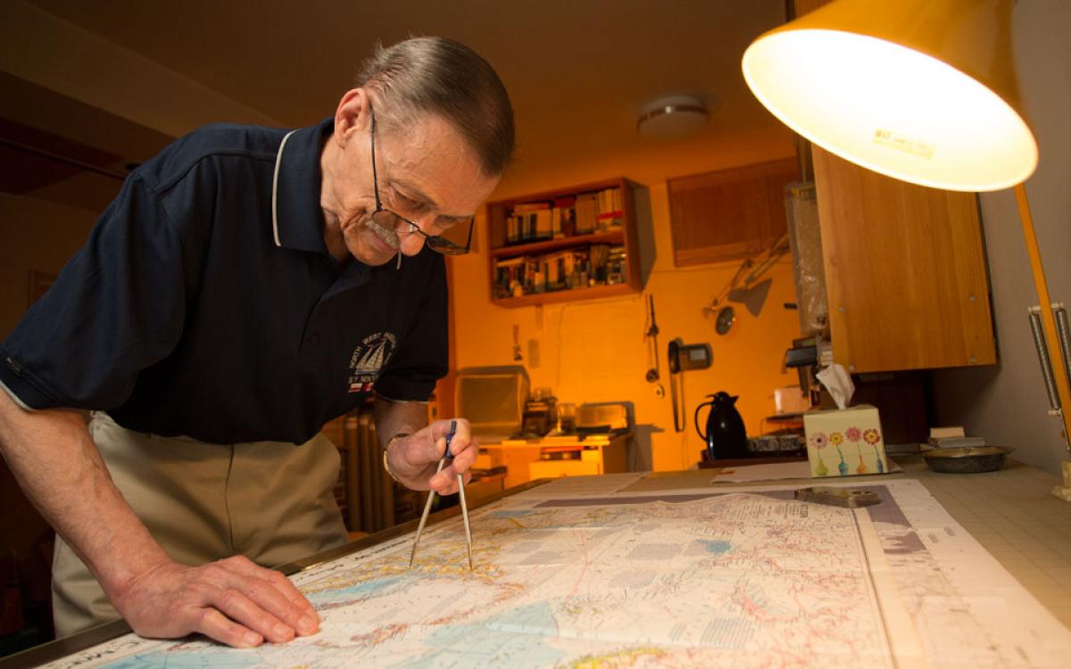
In Mississauga, we sit at Victor’s dining room table and sip coffee before he suggests we head down to NWP Studio—his basement office and a logistical hub for the famed Arctic waterway. His computer is set up alongside a drafting table overlaid with a navigational chart of the Canadian Arctic. There are a dozen rolled charts and maps in boxes, and photographs, plaques and certificates all over the walls highlighting his sailing and guiding exploits.
A sign reads, “Kindly hold your breath while I smoke.” He points to it, and lights up a cigarette after sitting me in front of a retrospective video made by a crew he guided last year. They thank Victor in the credits at the end.
“That was nice,” he says and takes a drag.

LAST SUMMER, Victor was on-call for a dozen sailboats that went through the passage. He was in contact with some crews more frequently than others through ‘sail mail,’ or satellite email. As of May 2018, when I met him at NWP Studio, eight groups had enlisted his services for the coming season. This entails dispatching navigational tools—charts, maps, ice charts and weather forecasts—and relaying the tides, currents, winds and features of the passage itself. He knows the moorings and the narrows and the tiny islands that don’t even warrant a dot on a map. He has a few pencilled in on the chart spread across his drafting table.
Once—sometimes twice—a day during open-water season from early August into September, the Canadian Ice Service releases ice condition reports for the Northwest Passage. Based on these reports, Victor advises sailors where to go and where to avoid using GPS coordinates the ships send out.
He pulls up an ice chart on his computer from July 2017 to explain the colour-coded ice cover markings: “Blue, that’s less than one-tenth of ice [cover]—practically no ice. Then green, yellow, brown, red—you can actually drive your car on that if there are no gaps.” You can travel in up to three-tenths ice cover with little difficulty, he says. But some people will push it into four- or five-tenths. “You have to just look for those little gaps opening. That ice is moving all the time because of the currents, the tides and the winds,” he says. “The Greenlanders, they go into eight-tenths in small boats, but all the time looking for small gaps and pushing ice.” That’s what Jens and Dorthe Kjeldsen from Greenland did last year, in a Northwest Passage trip documented in this magazine. “Jens made it through Peel Sound when nobody else made it. Dorthe, his wife, she’s been praying to the tide,” he laughs.
The ice reports usually come out in the evening, so most of Victor’s days are free. Depending on the precariousness of a crew’s situation, he may spend a day or evening emailing back and forth. In a challenging area, he’ll track the boat’s progress and whether it’s following the waypoints he suggested. If they’re off that course, he’ll send adjusted instructions. “I ask them for reports of dangerous ice around and send extra instructions,” he says. This may last for six to eight hours. In straight-forward cases, he’ll send one waypoint that’s good for a day or so, and follow their track every few hours. He says about one solo voyager last summer: “We are no kind of lovers, but we exchanged 700 emails.” Still, he manages to get away to his daughter’s cabin in the summer. It has internet access.
Victor pulls up a map with the track set by a sailboat last August. Connecting dots display its path from Requisite Passage to Storis Passage, and onward to Simpson Strait. Requisite and Storis are both pencilled onto Victor’s chart. They aren’t well documented on most charts, so they’re challenging and require a certain understanding in order to be navigated successfully. “Storis Passage, Requisite Passage, you have to follow to the inch,” he says. “There are lots of underwater pingos, which can be dangerous.” He pulls up the timestamps of the GPS coordinates sent by the sailboat as it traversed this stretch. There is one every minute.
LANDING AT THE EDGE of the frozen Arctic Ocean in the 1970s, Victor, a sailing enthusiast, wondered, how does one get across? “I was well aware of [Roald] Amundsen at that time,” Victor says. “I thought he was crazy.”
He kept abreast of expeditions in the 1970s and 80s—in particular a French yacht called Vagabond’eux. His mentor, Wojciech Jacobson, was on board. After two winters in the passage, Victor learned its captain had withdrawn and handed over command to Jacobsen. After a total of four seasons, the yacht made it back to France. The sheer length of the expedition through heavy ice with limited information or charts available to the crew didn’t sit well with Victor. “Learning all that made me uneasy and I started digging deeper into it,” he says. He found the available data disorganized, so he began to read up on the passage and gathered and collated information from people who had made specific crossings. And he started to communicate with people planning their own Northwest Passage voyages. “I came across totally unprepared people. They were begging me for the information,” he says. By 2006, he was seriously guiding them.
I tell Victor I was in Cambridge Bay late last summer and met a crew docked there that told me about heavy ice and risky passages they had encountered along the way. “I think the boat was called Celebration or something like that,” I say.
“Oh Charlie!” Victor exclaims. “I was guiding them.” Of course he was.
Last year, in the very heart of the Canadian Arctic, the ice barely went away, Victor tells me, pointing to an area between Prince of Wales Island and King William Island. “That’s where all the roads are crossing.” In one spot near the Tasmania Islands, off northwestern Boothia Peninsula, many boats waited 10 days for the ice to eventually break up. The common routes were clogged with ice. Knowing Charlie was an expert captain, Victor suggested a route between Tasmania and Toms islands, but warned of unknown depths in the slim channel. “He actually made the very first passage and found it’s deep enough,” Victor says with excitement.
Victor is quick to say that his advice is just that. “Whenever I send information, I always say to the captain or skipper, ‘It’s your decision to accept it or not—and you don’t have to even tell me if you do not accept it.’” But even the more experienced captains like Charlie tend to take it.
“'There are lots of underwater pingos, which can be dangerous.' He pulls up the timestamps of the GPS coordinates sent by the sailboat as it traversed this stretch. There is one every minute."
“YOU SHOULD ASK me what kind of boat I sail today,” Victor says. I do. He picks up a miniature wooden dory from the shelf above his computer and laughs. A friend who wintered in Lunenberg, Nova Scotia after making it through the passage under Victor’s guidance gave it to him as a thank you. She even had a plaque engraved with NWP Studio on the side of the four-inch boat. (No, he doesn’t have an actual sailboat right now.)
Victor doesn’t accept any sort of payment for his services. “It’s not my style.” For the past five years, he’s also prepared a routing guide for sailboats on the Northwest Passage that can be downloaded from the Royal Cruising Club Pilotage Foundation website. It includes descriptions of safe and unsafe harbours and areas that are poorly mapped. He notes places where nautical charts are lacking in detail—he provides adjustments down to the nautical mile—as well as where services like fuel and water are available. And he indicates which communities are official ports of entry to Canada. In Depot Bay, he even knows where to find the key to an abandoned Hudson’s Bay Company outpost. (New locks had to be put on as sailors in the 2014 season lost the old key.) The information is gathered from the many sailors he’s been in contact with on the passage. Twenty-one people are credited as contributors in the guide.
Though Victor has years of sailing experience, medals for his skills on the water and awards for his guiding efforts, he hasn’t actually sailed the Northwest Passage himself. (He was on board a barge carrying heavy construction equipment between Tuktoyaktuk and Kugluktuk as part of his work.)
But he has plans to do it one day. He’ll sail from east to west, and west to east—both directions in one season. “There’s one boat, probably will be on sale in Lewisporte in Newfoundland,” he says. “It’s with a lifting keel, steel fifty-footer. I’m keeping my eye on it. And my wife doesn’t know about that.”

