Joe McKenna's ears pricked up as a sound, just on the edge of his hearing, grew steadily louder. It was the unmistakable growl of a plane in the distance—a familiar sound in normal life, but here, completely alien. As quickly as it began, the sound faded. He never saw the plane.
“That was the only non-natural sound I heard for those 15 days.”
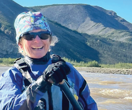
McKenna, a Vancouver computer programmer, and a group of adventurous friends were in Tuktut Nogait National Park back in July, a place that in the prior 2018-19 tourism season saw no visitors. Zero.
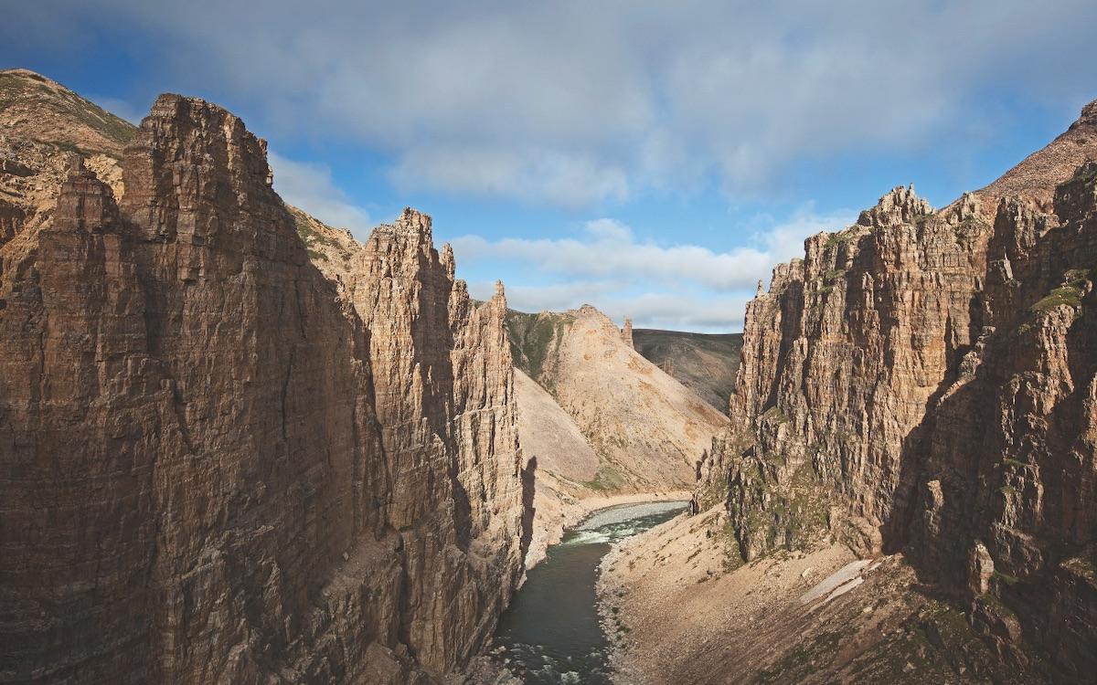
It’s not for lack of scenery. The park boasts stunning canyons with waterfalls as majestic as any postcard. Its wide-open tundra affords endless views. Its rivers froth and tumble with the best of them.
It’s not for lack of wildlife. Muskoxen, caribou, wolves and grizzly bears can be found ambling, gambolling, prancing, lying down and doing all the other wildlife things that wildlife do throughout the park.
The real challenge is simply distance. Getting into the park costs time and, especially, money. For McKenna and his group, it was a $23,000 charter flight from Norman Wells—itself an $800 flight from Yellowknife—to get into the park, located about 40 kilometres east of Paulatuk in the far North.
But for those who can stomach the cost, it’s a rare chance to be truly out there.
“We were actually drawn to Tuktuk Nogait because it would be the most isolated place we’d ever been,” McKenna says of his group, which visits remote northern destinations like most people visit Holiday Inns. “More people orbit the Earth than visit the park every year.”
Not all under-visited northern parks are quite as remote, expensive or hardcore as Tuktut Nogait. Some may tick just one of those boxes, while others are simply hidden gems. For every Nahanni (which averages 900 annual visitors) or Tombstone (19,576 visitors in 2017), there are a dozen places—historical sites, territorial parks and national parks—that have just as much to offer adventure seekers look- ing for a unique experience. Here are a few options.

COAL RIVER SPRINGS TERRITORIAL PARK
LOCATION: EAST OF WATSON LAKE, YUKON
ESTABLISHED: 1990
VISITORS IN 2018: UNKNOWN
HOW TO GET THERE: WHITEWATER, BLACK AND BLUE BODY, OR GREENBACKS
A natural marvel, the Yukon parks service describes Coal River Springs as resembling “a staircase of dripping colour.” The gorgeous limestone formations look like a terraced hill of farmland, but the processes that created them are all-natural: dissolved limestone is deposited at the edges of pools, which rise up at a rate of about two centimetres per year, eventually encapsulating themselves entirely.
Protecting the limestone formation is the primary purpose of the park, as the unique ecological features are highly sensitive to human impact.
Getting there means either dropping in via a week-long whitewater paddle through rapids or bushwhacking a punishing route the government describes as “difficult, if not impossible”—and still only gets you to the wrong side of the river. If neither of those sounds like your kind of trip, you can shell out for a helicopter flightseeing trip from Watson Lake.
THAIDENE NËNÉ NATIONAL PARK RESERVE
ESTABLISHED: 2019
VISITORS IN 2018: N/A
HOW TO GET THERE: SOON
Thaidene Nëné is Canada’s newest national reserve, and as such, it’s designed to reflect where Canada is politically and environmentally in 2019. The park is co-managed between Parks Canada, the Government of the Northwest Territories and the /Lutselk’e Dene First Nation, and that co-management includes funding for Indigenous guardians. The guardians patrol, monitor and protect the park, which is on the First Nation’s territory.
Although the park on the east arm of Great Slave Lake just opened, the formal process to create it has been underway for more than a decade, and the first efforts were made in the 1960s. During that time, a small but growing ecotourism industry has emerged in /Lutselk’e, catering largely to sport fishers—the park is home to world-class fishing thanks to its deep, cold waters.
As the baby in the national parks family, it’s hard to know what Thaidene Nëné will grow up to be. Will it be the next Nahanni, or will it be destined to remain a hidden gem like the other sites on this list? It’s an easy 40-minute flight from Yellowknife (and the capital’s ongoing tourism boom) but the crowds will need some prodding to make the trip. There’s only one way to find out if it’s worthwhile; see it for yourself.

HERSCHEL ISLAND – QIKIQTARUK TERRITORIAL PARK
LOCATION: OFF YUKON’S ARCTIC COAST
ESTABLISHED: 1987 YUKON
DISAPPEARING: BY 2070
VISITORS IN 2016: 293
HOW TO GET THERE: FLOATING HOTEL
Most visitors to Herschel Island come by ship, which is fitting because the island is popularly known as the site of that other Yukon gold rush: a whaling post that brought in some of the most valuable catches in the Arctic. The outpost was established long before Europeans arrived in the 19th century, used by Inuvialuit for whaling, but that arrival led to the death of 90 per cent of the Inuvialuit from influenza. Whaling only went on for 22 years, but it left the most notable island features behind. You can visit sheds and former homes, see whaler tools, machinery, and graves and find whale bones scattered amongst the driftwood.
The park has more to offer outside of the whaling base, however. A short walk brings you to rolling tundra where musk- oxen and other wildlife are found. With climate change, that landscape is being transformed as the permafrost underneath thaws. Landslides on the coastal cliffs are common, but the worst is yet to come; much of the shoreline will be beneath the sea within 50 years.
The best way to reach the island is by cruise ship or plane, though some hardy kayakers head down the Firth River. But the low, exposed island offers little in the way of shelter. So pack a toque.
INUKSUK POINT NATIONAL HISTORIC SITE
LOCATION: SOUTHWEST BAFFIN ISLAND, NUNAVUT
ESTABLISHED: 1969
VISITORS IN 2018: UNKNOWN
HOW TO GET THERE: FOLLOW THE INUKSUIT
The inuksuk is a symbol of Nunavut— found on its flag and across the land. Without trees or high brush to obscure the view, even small inuksuit can be seen from far away on the featureless landscape, and so the figures have been used for centuries as landmarks, guiding hunters home, herding wildlife, or marking important places.
One such important place is Inuksuk Point. Located on the Foxe Peninsula, about 88 kilometers from Cape Dorset, it’s home to more than 100 inuksuit—the largest collection in one place anywhere in the world—with some as tall as six or seven feet, that could have been built as long as 2,000 years ago.

TUKTUT NOGAIT NATIONAL PARK
LOCATION: EAST OF PAULATUK, NWT
ESTABLISHED: 1998
VISITORS IN 2018-19: 0
HOW TO GET THERE: SECOND MORTGAGE
Tuktut Nogait is a hermit’s paradise: a sprawling 18,100-square-kilometre zone with nobody in it. Even Parks Canada acknowledges on its website that the park is mostly visited by “the privileged few.”
But that wasn’t always the case. More than 400 archaeological sites have been identified within Tuktut Nogait dating back to at least 1000 AD. The park’s rules reflect that history and tradition: Inuvialuit subsistence hunting and fishing happens inside the park, which is home to the calving grounds of the Bluenose Caribou Herd.
Activities for park visitors include hiking through the tundra, paddling the Hornaday River, and spotting the thundering caribou herd. The park’s name even alludes to their importance, meaning “young caribou” in Inuvialuktun.

UKKUSIKSALIK NATIONAL PARK
LOCATION: SOUTH OF NAUJAAT, NUNAVUT
ESTABLISHED: 2003
VISITORS IN 2018-19: 1
HOW TO GET THERE: CAREFULLY
The visitor guide for Ukkusiksalik National Park reads more like a list of ways to die than a welcome package: thin ice, open ice, extreme weather, rough water, polar bears, foxes, walruses, and river crossings, among other hazards. So, you know, it’s not Disneyland.
Call up the receptionist at the Naujaat Parks Canada office and ask for visitation stats for the prior year and she’ll know the number off-hand. “There was a photographer,” she says. That's singular.
The reason for the low visitation is that hard-sided accommodations (i.e. not tents) are needed to adequately repel nature’s fury. Otherwise, you’ll need solar-powered electric fences and a sentry posted to guard against polar bears.
Visitors to Ukkusiksalik are able to access the park’s historic and beautiful setting of Wager Bay, which plunges deep into the northwest corner of Hudson Bay—so deep, in fact, that it was repeatedly explored as a candidate for the fabled Northwest Passage.
Dorset and Thule peoples inhabited the area from as much as 1,500 years ago, and tent rings, fox traps, and other archaeological sites can be found (but not touched) throughout the park today. There are also the remains of a Hudson’s Bay Company trading post dating back to 1925.
The bay ends at Ford Lake, where strong tidal currents create a rare “reversing waterfall,” one of only three in Canada.
Just don’t go swimming in the falls; it should go without saying by now, but it’s dangerous.

