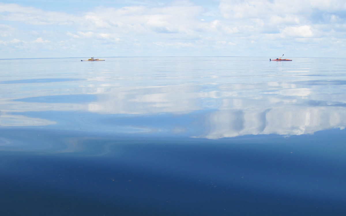
With our kayaks resting on a gravel bar, we sit under the hot sun on a hilltop overlooking the Thelon River after a lunch of peanut butter, jam, bread, nuts, granola bars and lemonade. The water is deep blue, bounded by white riverbanks and dark green tundra. A breeze keeps the bugs away as I feel guilty about our meal. About a kilometre downriver, a British trapper and his two partners starved to death in 1927. We intend to visit the remnants of John Hornby’s cabin and the three gravesites tomorrow. Our interest in Hornby is partly why my friend Paul and I are here, in July 2003, paddling 1,050 kilometres down the Thelon to Baker Lake. We didn’t know when we started the trip that we’d get another history lesson along the way.
Paul and I have done unsupported expeditions down many northern rivers, including the Clearwater, Coppermine, Kazan, Keele and Nahanni. The Thelon flows through an area larger than Texas, with no towns and no roads. This trip would take us 33 days, and we’d packed two Klepper II kayaks—folding wooden boats of German design—with about 210 kilograms of camping gear, spare paddles, dehydrated food and emergency supplies.
Many official geographical names on our maps—The Gap, Halfway Lake, Axecut Lake, Grassy Island, Downtree Lake—came from surveyors or trappers during the 1920s and ’30s. Hornby has a point named after him. But one moniker is unlike the others. When we started our trip at Whitefish Lake, bush pilot and wilderness guide “Tundra Tom” Faess told us that Cosmos Lake was named for the Cosmos 954 Soviet satellite that crashed in the area in January 1978.
Powered by a nuclear reactor and 45 kilograms of uranium, the satellite re-entered the earth’s atmosphere and scattered debris over 124,000 square kilometres of Alberta, Saskatchewan, the Northwest Territories and what’s now Nunavut. The potential for radioactive contamination caused a stir. An RCMP officer in Hay River saw a “bright white and incandescent” glowing object falling to earth, and according to Time magazine, when he learned it was a uranium-laden satellite, he said: “My gosh, I was standing on the roof watching it go by. Maybe I’m sterile.” The Canadian and American militaries conducted an eight-month cleanup, with a temporary base at the newly named Cosmos Lake, featuring an air strip and tent city. Less than one per cent of the satellite’s material was ever recovered.
Though Paul and I didn’t know the history of Cosmos Lake at the trip’s outset, it doesn’t lessen our keenness to find Hornby’s cabin in the satellite’s fall zone. We’d marked the approximate location of the lake—and a cairn installed by the federal Department of National Defence—on our maps, and we look for the narrows that will indicate we’re in the right place. We pass Grassy Island and approach Bottle Island on a wide, sweeping right turn. Then we cruise the bend and, by the time we land on shore, we see that we’ve passed the narrows. The bank is high and muddy with breakup ice pushed on top. I can see a cairn with my binoculars, about a kilometre upstream and 100 metres inland.
Paul sighs. He wants to get to Hornby’s cabin, but I want to see the cairn. We have a “no regrets” pact, so to the cairn I go. “I’ll wait for you here,” Paul says. The current is too fast to paddle upstream, so I slog on foot along the bank, crossing the channel and filling my wetsuit boots with warm, muddy water. I walk around a pond and into the brush on trails beaten into the ground by muskoxen. Their splayed hoof prints and ox-pies are everywhere. After an hour, I clear the brush and walk up the hill to the cairn. To the north is the platinum-grey water of Cosmos Lake. I press my hand over the rough cement and smooth plaque and hurry back to my impatient pal.
The next day, we paddle downstream under a cloudless sky with west winds. Two adventurers travelling along the river in 1978 discovered a large satellite fragment just a few days after the crash: two pieces with struts attached to a soft metal plate. Using our map and Faess’s directions—“At the end of the gravel where the green begins, about 100 yards in”—we try to pinpoint the location of Hornby’s cabin. We have no GPS co-ordinates on which to home in.
After a sweeping S-bend, the north bank appears to be an excellent location for a cabin. We pull off the river and search the thick forest unsuccessfully, then paddle 50 metres downstream to the next gravel bar and try again. With our bug jackets on, we wander through tall spruce, treading on a moss-lichen forest floor and caribou droppings. Paul spots an axe-cut tree—a sign of cabin construction or firewood gathering. Then we spook an Arctic hare that hops down the trail ahead of us. We follow and find the remains of the cabin and three graves, marked by teetering grey crosses carved with the initials of Hornby and his partners: Harold Adlard and Hornby’s 18-year-old cousin Edgar Christian.
Hornby died first, in April, and Adlard followed about two weeks later. Christian kept a journal until his death in June. His last entry read, “Got out too weak all in now Left Things Late,” and then he stashed the book in the cold stove. The men had planned to hunt and trap all winter, but they arrived too late for the caribou migration. Muskoxen were nearly extinct in the area at the time. Within the sagging log walls, I see a piece of rusting stove pipe and think of Christian. The scene is eerie. Paul and I are quiet, and we don’t take any trophy photos of the cabin. When we return to our boats, we find our voices and our appetites, eating bannock and rye bread with jam and peanut butter.
We paddle about 43 kilometres that day. In my soaked wetsuit boots, my feet turn soggy. Skin peels away in thin layers for days afterwards, and I wonder about radiation exposure.
On day eight, I sit on a rock in the sun at Beverly Lake and spread my pink toes wide to dry between them. My new skin glows red and itchy, sunburned in 10 minutes. We make it to Baker Lake two weeks later. As I’ve continued my northern adventures in the years since, I haven’t set off any radiation detectors.