Yukoner Ed Whitehouse was never much for technology, so at the advent of snowmachines, he stuck to his dogsled to get around. It’s a decision that saved his life when, decades ago, he fell through the ice. “As long as you can crawl and get into that sleigh, the dogs can bring you home. A snowmobile wouldn’t do that,” he said at the time. Whitehouse has since passed on but his sled—and his words—can be found at the Yukon Transportation Museum in Whitehorse, where director Janna Swales shares Whitehouse’s story with visitors as an example of Yukon grit and self-sufficiency—qualities she says that, paired with ingenuity, can be found in many Northern travel stories. These travel routes embody those qualities and attract thousands of visitors to the territories each year.

Travel back in time
“They said it couldn’t be built, it was impossible,” Swales says of the 177 km (110 miles) train track that winds through mountainous terrain between Skagway, Alaska and Whitehorse, Yukon. Following a trade route used by horses and hikers, the White Pass and Yukon Route Railway was built to handle Klondike Gold Rush traffic. Construction took two years and the line opened in 1900. This last narrow gauge rail line operating in Canada was engineered for steep slopes and cutting turns that a wider-gauge train couldn’t handle. It climbs 3,000 feet in just 33 kms.
“When the trains started operating, all of a sudden there was a quick-ish connection between Whitehorse and Skagway [with a water connection] on to Dawson City,” Swales says. The railway was pivotal in the construction of the Alaska Highway during the Second World War. Later, ore from Yukon mines made up 70 per cent of White Pass freight. When the Faro mine closed in the early ’80s, so did the rail line. It re-opened in 1988 as a tourist route between Skagway and Carcross with bus connections to Whitehorse. Take a day-long ride into the past in vintage rail cars, with eye-popping scenery, tense mountain climbs, and the romance of a century ago.

Air reigns supreme
You can’t reach Nunavut by road–not yet, maybe never. But you can fly into every community, with some of the smallest connected to larger centres by up to five flights per week. Sounds convenient and accessible, but visitors are reminded that weather can play havoc with flight schedules. The two biggest problems are blizzards in winter, and fog in spring and fall.
If you’re planning a visit to Nunavut, and you’re not in a hurry, then try a milk-run flight. Yep, it’s one of those flights that makes stops in a couple of communities before it gets to your final destination. Usually the stops are pretty brief, but it does give you a chance to see the geographic setting, an aerial view of the community and just what supplies (from groceries to motorbikes) are unloaded in each community.
An all-weather road from northern Manitoba to the Kivalliq region of Nunavut was studied extensively, but the idea was dropped some years ago, although discussion continues regarding a potential winter road.
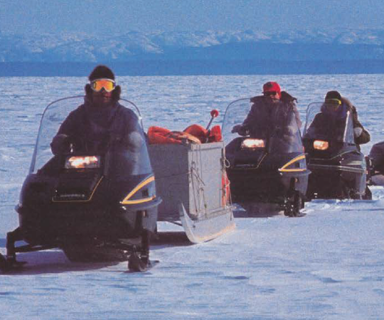
Getting around locally is also a bit of an adventure. Dog teams still exist mainly for recreational use, but the king of the road (and the tundra) is the snow machine for most of the year, and the sturdy ATV for the rest. Hop on a komatik, drawn by a snow machine, and hold on as best you can. Land travel in Nunavut is seldom a smooth ride. But it is definitely authentic.

Arctic Ocean or bust
It took almost 60 years to complete a road connection to the Arctic Ocean, but recent visitors will tell you it was well worth the wait.
John Diefenbaker announced the Dempster Highway connecting Dawson City, Yukon, and Inuvik, NWT, way back in 1958, but it was over 20 years before that route through mountains and tundra was completed. The next obvious link was a road to the Arctic Coast and Tuktoyaktuk, then headquarters for a far north oil and gas boom. It took another 38 years to get that road completed, long after the oil and gas explorers had gone.
Today the combo Dempster and Inuvik-Tuk highways provide one of the most extreme driving adventures in the world. The Dempster winds through spectacular mountain scenery and across broad river plains, while the Inuvik-Tuk portion slices across one of the world’s greatest river deltas.
Today, visitors can travel by vehicle from central Yukon to the Arctic in a couple of days, but the trip may claim a couple of tires. Yes, the North is more road-connected today, but beautiful paved roads in the Far North are still a dream.

Elusive no more
The first expedition to traverse the Northwest Passage was led by Norwegian Roald Amundsen. It took him three years back in 1903-06. The second successful expedition was led by Captain Henry Larson of the RCMP. He cut a year off Amundsen’s time, completing the route from Vancouver to Halifax in two years, in 1944. These two succeeded, where many had failed and lost their lives in the process.
Today, due to improved technology and warming weather, the Northwest Passage is host to dozens of cruise ships, large and small, that cover portions or all of the passage, travelling in both directions. Last year 3,400 travelers visited Nunavut communities via the marine corridor. The largest cruise ship to ever try the passage was the Crystal Serenity. The ship completed its 2016 journey in 32 days with over 1,000 paying passengers, but Crystal discontinued use of such a large ship after the 2017 season.
Many of the 44 cruise ships in 2018 stopped at Pond Inlet, at the eastern entrance to the passage. In addition, each year an increasing number of smaller pleasure craft head for the icy waters in hopes of traversing the passage–an extreme trip for only the most adventurous.
First highways of the NWT
The first road between Alberta and the Northwest Territories was completed in 1948. It connected Grimshaw, Alberta and Hay River, NWT. Before that, rivers provided the only access to the Northwest Territories. Everything that came into or went out of the territories was carried by boat on the Athabasca, Slave and Mackenzie Rivers. This nearly 3,000 km water route included two portages, with the most challenging at Fort Smith, around a series of treacherous rapids in the Slave River.
With the arrival of the road, Hay River became the transportation hub of the North, where ships picked up freight for communities along the Mackenzie River and the Arctic Coast. A rail line carrying freight was completed to Hay River in the early ’70s.
Today travelers can drive a circular route, known as the Deh Cho Connection, which connects 10 NWT communities to the outside world. Visit the rapids at Fort Smith and imagine the challenges of transporting supplies on the portage. Follow the Mackenzie Highway north to Wrigley with an extension planned to Norman Wells, and return south on the Liard Highway–a leisurely week-long drive, but impossible just 60 years ago.

Epic route–then and now
If you’re looking for a route that highlights some of the attractions the Yukon is famous for, then try a weeklong drive around the Golden Circle. This route spans two countries and is connected by a common history–the search for gold. On the way you’ll climb mountains, ride a ferry, see the world’s smallest desert, marvel at a turquoise lake, visit two national parks (Kluane at Haines Junction and Klondike Gold Rush National Park in Skagway, Alaska) and get a feel for life in five northern communities –six if you decide to take the Marine Highway to Juneau.
Parts of the route follow the original Alaska Highway, built for military purposes and completed in record time in 1942 (although not opened to the public until 1948). Today this rugged route is mainly paved.
The Golden Circle is a four- to seven-day trip depending on just how much you want to see and do along the way. The attractions menu offers plenty of variety: wildlife viewing, or stopping at a bald eagle preserve, mountain hiking, delving into history, or taking time out to try your hand at salmon fishing.


